Ground Penetration Radar for Historic Cemetery – Geologist Survey Services
/Blog/Current-Projects/Current-Projects/Ground-Penetration-Radar-for-Historic-Cemetery--Geologist-Survey-Services/?link=1&fldKeywords=&fldAuthor=&fldTopic=0
The African American Heritage Preservation Foundation undertook a Ground Penetrating Radar (GPR) imaging survey to develop a picture profile and determine the location of unmarked graves in the Historic Stanton Family Cemetery, Buckingham County, Virginia. This imaging is an excellent tool for cemeteries with non-existent or destroyed burial records.
A GPR Survey can produce a composite site map of an area that would indicate grave locations as well as position and depth. The community was invited to observe this process.
Pro bono land surveying services were provided by Maxey & Associates, P.C. to map the 49 graves based on the GPR imaging.
This project was sponsored by Premier Consultants International, Inc.
The African American Heritage Preservation Foundation undertook a Ground Penetrating Radar (GPR) imaging survey to develop a picture profile and determine the location of unmarked graves in the Historic Stanton Family Cemetery, Buckingham County, Virginia. This imaging is an excellent tool for cemeteries with non-existent or destroyed burial records. A GPR Survey can produce a composite site map of an area that would indicate grave locations as well as position and depth. The community was invited to observe this process.
On March 14, 2020, GeoModel provided the GPR survey for the Historic Stanton Family Cemetery. Initially, this cemetery was known to have at least thirty-six grave sites. Through this technology, a total of 49 grave sites were found.
Pro bono land surveying services were provided by Maxey & Associates, P.C. to map the 49 graves based on the GPR imaging.
This project was sponsored by Premier Consultants International, Inc.
A Case Study of the GPR process.
/Blog/Current-Projects/Current-Projects/AAHPF--provides-a-10000-grant-to-the-Upton-Planning-Community-Inc-for-the-restoration-of-Congressman-Parren-Mitchells-home/?link=1&fldKeywords=&fldAuthor=&fldTopic=0
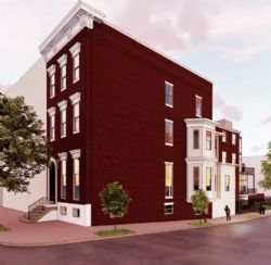
The African American Heritage Preservation Foundation, Inc. provides a $10,000 grant to the Upton Planning Community, Inc. (UPC) for the restoration of Congressman Parren J, Mitchell's home in Baltimore, Maryland. The African American Heritage Preservation Foundation, Inc. has recently launched their African American Endangered Sites Matching Grants Pilot Program to support eligible 501(3) organizations to complete its restoration and maintenance projects for historic sites. The Parren J. Mitchell House represents the legacy of a pioneering civil rights leader and a significant chapter in American history. Congressman Mitchell served in the US House of Representatives for 16 years. The structure was built in 1855 and was listed on the National Register of Historic Places in June 2023.
/Blog/Current-Projects/Current-Projects/Congratulations-to-HAI-Architectural-Interns-from-Howard-University/?link=1&fldKeywords=&fldAuthor=&fldTopic=0
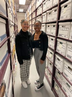
HAI extends its sincere gratitude to our two interns from Howard University, Kolbi Holston and Farrington Asberry-Lindquist, as they complete their time with us. Just graduated fifth-year architecture students, they were a wonderful addition to our team as they worked on collections to spotlight our partnership with the AFRICAN AMERICAN HERITAGE PRESERVATION FOUNDATION INC and its President and Founder, E. Renee Ingram. We extend our thanks, as well, to Professor Edward Dunson, Jr. AIA, at Howard University for his leadership and guidance as we established this internship program. We are excited to pursue this relationship in years to come!
/Blog/Current-Projects/Current-Projects/Selfguided-map-and-app-unites-stories-of-African-American-heroes-historic-places-and-events/?link=1&fldKeywords=&fldAuthor=&fldTopic=0
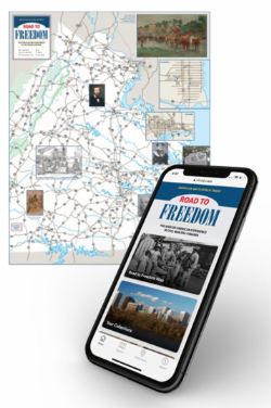
The "Road to Freedom" program, created through a partnership between the American Battlefield Trust and Civil War Trails, Inc., offers free physical and digital manifestations — a map guide available in visitor centers and distribution sites across the state and a web app with downloadable versions for Android and iOS devices. The trail highlights 88 spots across Virginia, a key Civil War battleground state and an important passageway in the Underground Railroad. Sites stretch from Alexandria, just outside Washington, D.C., to Abingdon, near the Tennessee border, and tell stories of soldiers, slaves, educators, politicians and others, marking the places where they staged rebellions, fought for freedom, educated their children, were born and were buried.